Hey! I'm Dylan, a Software Engineer with over 8 years of experience.
About Me
What started as a small coding project to make my own life easier has transformed into a passion for developing systems and software for myself and others.
When I'm not coding, I am...learning new languages, modifying cars/bikes, and traveling the world.
My projects
Client Work
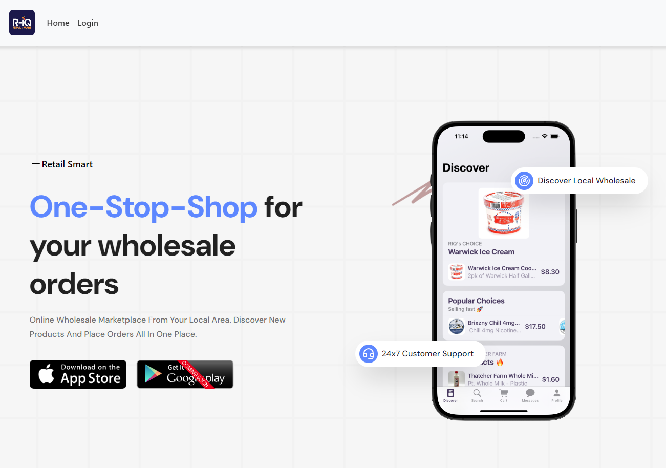
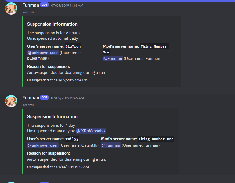
Automated Moderation Services
Software Engineer
Nov 2017 - Apr 2021
Chatting platform moderation tools reaching over 50k users. Built for scale and reliability.
- Javascript
- Node.js
- SQLite
Industry Experience
Pfizer
Automation Engineer
Sep 2022 - Present
Modernized legacy control systems and integrate new automated equipment to enhance process reliability.
- PLC
- SCADA
- SQL
- Rockwell
- Visual Basic
Technical Expertise
Industrial Automation
- PLC
- SCADA
- Rockwell
- GE iFIX
- PLC-5
- FactoryTalk
- OSI PI
- Dream Report
- Validation
- GMP
Software Engineering
Get In Touch
Let's collaborate on your next project!